Airedale General Hospital is using a geospatial indoor mapping system from Esri UK to manage its Reinforced Autoclaved Aerated Concrete (RAAC) monitoring and repair system.
According to the software provider, use of the indoor mapping system helps ensure the safety of patients and hospital staff, while making the process of inspecting 20,000 concrete planks 50% more efficient.
The Geographic Information System (GIS) software, provided by Esri UK, replaces paper-based processes with digital workflows in an effort to improve the accuracy and efficiency of Airedale General's RAAC inspections.
Esri's ArcGIS system can reveal in real time where the most at-risk areas are. This data is then used by Airedale General to inform mitigation works.
Richard Burgin, Property Project Manager at Airedale General Hospital, said: “Esri GIS has given us a more robust and resilient process, with reduced risk of human error that instantly shows different levels of risk so we know what to focus on. RAAC has a major operational impact, sometimes disrupting clinical and operational functions. Investigations and mitigation works therefore need to be accurate and rapid and the system supports this.
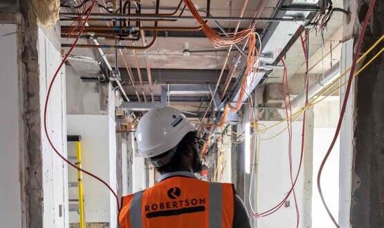
The hospital has one of the largest quantities of RAAC panels in the NHS, with 83% of the hospital's floors, walls and ceilings made from the material. It is expected to be rebuilt by 2030 as part of the government's new hospital program.
But until then, mitigation works – including temporary props, steel reinforcements and repairing roof leaks – are underway to maintain safe operations at the site.
Using the software, inspection data is now captured using custom forms on iPad. Boards are inspected monthly, quarterly, semi-annually or annually, in accordance with current guidelines and the rating of each board.
The tool can run different spatial analyzes and scenarios, providing faster and improved insights. It also takes into account factors that impact RAAC, such as weather conditions and a building's orientation, to improve ratings.
This also helps direct the survey team to the services to be inspected and the boards that need to be inspected.
The digital workflow provides Airedale General with an audit trail supporting compliance and reporting, which is directly linked to the government funding it receives to manage the RAAC.
Burgin continued: “GIS is a powerful tool that helps manage the volume of work, provides a single source of truth on RAAC risk and helps prioritize areas where repairs and interventions should focus to keep operations running smoothly. safe from hospital.
“The digital approach increases the accuracy of data and makes it more shareable, improving the ability to communicate the scale and complexity of the problem, both with internal and external stakeholders. »